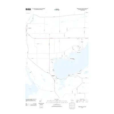
2013 Map of Princeton East
USGS Topo · Published 2013About this map
Green Lake dominates the eastern half of this landscape, its deep waters framed by the residential developments of Sylvan Shores, Greenwyck, and Green Lake Terrace. This 2013 survey illustrates the area's long-standing transition from a river-and-lake frontier to a premier recreation destination, exemplified by the sprawling Golf Courses of Lawsonia along the northern shore. On the western edge, the Fox River meanders toward Puckaway Lake, while the settlement of Princeton anchors the northwest corner of the quadrangle. The map reveals a dense network of local roads such as Old Saint Marie Rd and Wicks Lndg, tracing the paths of earlier pioneers. Notable landmarks like Lone Tree Point, Blackbird Point, and the peninsula known as Sugarloaf provide essential orientation for those studying the evolution of Wisconsin's resort culture and historic lakefront property lines.
Find a feature on this map
62 named features on this map. Tap any name to fly to it.
Don’t see what you’re looking for? This feature index may not catch every label — zoom into the map to look around manually.
Map Details
Editions of this 2013 Princeton East Map
This is the sole edition of this map. No revisions or reprints were ever made.
Other maps of this area

1915 · Neshkoro
USGS Topo · 1:48,000

1916 · Ripon
USGS Topo · 1:48,000

1918 · Neshkoro
USGS Topo · 1:62,500

1918 · Ripon
USGS Topo · 1:62,500

1955 · Randolph
USGS Topo · 1:62,500

1955 · Fox Lake
USGS Topo · 1:62,500

1956 · Ripon
USGS Topo · 1:62,500

1957 · Madison
USGS Topo · 1:250,000

1960 · Madison
USGS Topo · 1:250,000

1963 · Neshkoro
USGS Topo · 1:62,500