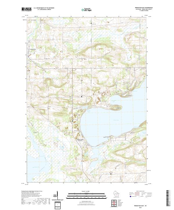
2022 Map of Princeton East
USGS Topo · Published 2022About this map
Green Lake dominates the central landscape of this Green Lake County survey, showing a complex shoreline defined by points and bays. To the northwest, the Fox River meanders toward the city of Princeton, while the southern reaches of the map show the marshy fringes of Puckaway Lake. The area's agricultural and social history is marked by several rural burial sites, including Mount Tom Cem, Weiser Cem, and Grand Prairie Cem, which serve as anchors for genealogical research in the townships. Residential development is clustered at Green Lake Terrace and along the northern shore near Quimby Bay. The map captures a transition between the deep waters of the lake and the surrounding wetlands drained by Snake Creek and Spring Creek. Notable landmarks such as the Sugarloaf and Lone Tree Point provide topographic context for the glacial terrain that characterizes this part of Wisconsin.
Find a feature on this map
87 named features on this map. Tap any name to fly to it.
Don’t see what you’re looking for? This feature index may not catch every label — zoom into the map to look around manually.
Map Details
Editions of this 2022 Princeton East Map
This is the sole edition of this map. No revisions or reprints were ever made.
Other maps of this area

1915 · Neshkoro
USGS Topo · 1:48,000

1916 · Ripon
USGS Topo · 1:48,000

1918 · Neshkoro
USGS Topo · 1:62,500

1918 · Ripon
USGS Topo · 1:62,500

1955 · Randolph
USGS Topo · 1:62,500

1955 · Fox Lake
USGS Topo · 1:62,500

1956 · Ripon
USGS Topo · 1:62,500

1957 · Madison
USGS Topo · 1:250,000

1960 · Madison
USGS Topo · 1:250,000

1963 · Neshkoro
USGS Topo · 1:62,500