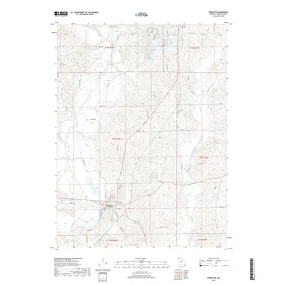
2017 Map of Princeton
USGS Topo · Published 2017About this map
Princeton serves as the primary hub of this North Missouri landscape, situated at the confluence of several local transport routes. The town is anchored by a traditional grid including W Main St and S College Ave, while its surrounding hills are dotted with a high density of rural burial grounds such as Princeton Cem, Underwood Cem, and Fairview Cem. The hydrology of the region is defined by the meandering path of the Weldon River and the eastern flow of Muddy Creek.
Find a feature on this map
72 named features on this map. Tap any name to fly to it.
Don’t see what you’re looking for? This feature index may not catch every label — zoom into the map to look around manually.
Map Details
Editions of this 2017 Princeton Map
This is the sole edition of this map. No revisions or reprints were ever made.
Other maps of this area

1946 · Princeton
USGS Topo · 1:62,500

1948 · Princeton
USGS Topo · 1:62,500

1954 · Centerville
USGS Topo · 1:250,000

1957 · Centerville
USGS Topo · 1:250,000

1958 · Centerville
USGS Topo · 1:250,000

1964 · Ravanna
USGS Topo · 1:24,000

1964 · Half Rock
USGS Topo · 1:24,000

1964 · Pleasanton
USGS Topo · 1:24,000

1964 · Cleopatra
USGS Topo · 1:24,000
1964 · Lineville
USGS Topo · 1:24,000