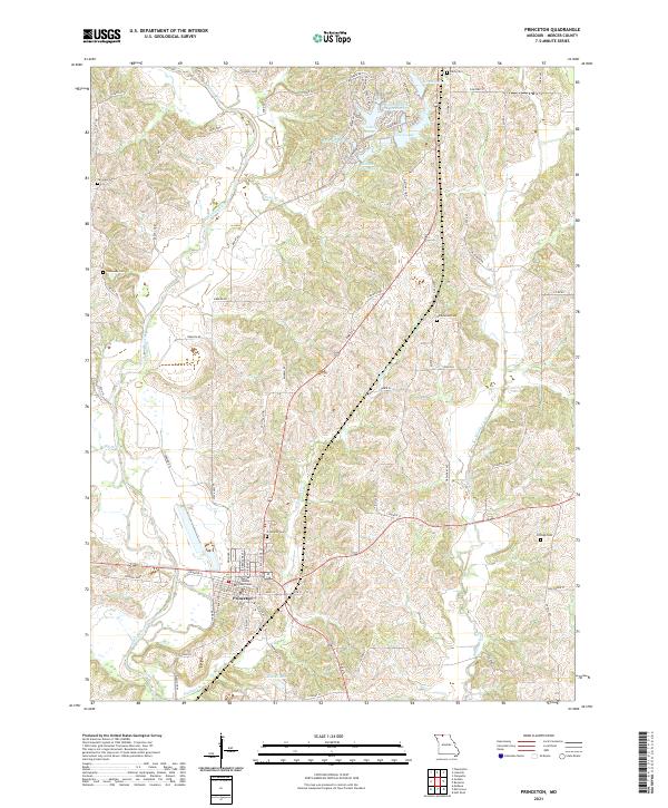
2021 Map of Princeton
USGS Topo · Published 2021About this map
Princeton serves as the focal point of this North Missouri landscape, anchored by the Mercer County Courthouse and surrounded by a network of rural roads and watercourses. The town is situated along the Weldon River, which winds south through the western half of the terrain. The northern section of the map reveals a shift toward modern residential planning around several recreational water bodies, including Lake Marie, Hidden Valley Lake, and Berndt Lake, where street names like Atlantic Ave and Caribbean Ave deviate from the standard rural grid.
Find a feature on this map
83 named features on this map. Tap any name to fly to it.
Don’t see what you’re looking for? This feature index may not catch every label — zoom into the map to look around manually.
Map Details
Editions of this 2021 Princeton Map
This is the sole edition of this map. No revisions or reprints were ever made.
Other maps of this area

1946 · Princeton
USGS Topo · 1:62,500

1948 · Princeton
USGS Topo · 1:62,500

1954 · Centerville
USGS Topo · 1:250,000

1957 · Centerville
USGS Topo · 1:250,000

1958 · Centerville
USGS Topo · 1:250,000

1964 · Ravanna
USGS Topo · 1:24,000

1964 · Half Rock
USGS Topo · 1:24,000

1964 · Pleasanton
USGS Topo · 1:24,000

1964 · Cleopatra
USGS Topo · 1:24,000
1964 · Lineville
USGS Topo · 1:24,000