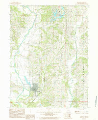
1984 Map of Princeton
USGS Topo · Published 1984About this map
The Mercer County seat of Princeton serves as the focal point of this 1980s landscape, positioned where the Chicago and North Western railroad corridor meets the drainage of the Little Weldon River. The topography is defined by the winding paths of Wildcat Creek and Muddy Creek, which carve through the townships of Marion, Morgan, and Ravanna. Significant water features and recreational modifications are evident in the north, including Lake Marie, Twin Lakes, and Hidden Valley Lake.
Find a feature on this map
15 named features on this map. Tap any name to fly to it.
Don’t see what you’re looking for? This feature index may not catch every label — zoom into the map to look around manually.
Map Details
Editions of this 1984 Princeton Map
This is the sole edition of this map. No revisions or reprints were ever made.
Other maps of this area

1946 · Princeton
USGS Topo · 1:62,500

1948 · Princeton
USGS Topo · 1:62,500

1954 · Centerville
USGS Topo · 1:250,000

1957 · Centerville
USGS Topo · 1:250,000

1958 · Centerville
USGS Topo · 1:250,000

1964 · Ravanna
USGS Topo · 1:24,000

1964 · Half Rock
USGS Topo · 1:24,000

1964 · Pleasanton
USGS Topo · 1:24,000

1964 · Cleopatra
USGS Topo · 1:24,000
1964 · Lineville
USGS Topo · 1:24,000