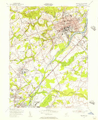
1954 Map of Princeton
USGS Topo · Published 1956About this map
Princeton University dominates the academic and cultural landscape of this mid-century survey, surrounded by venerable institutions like the Theological Seminary and the Westminster Choir College. The map illustrates a dense concentration of educational history, from the Lawrenceville School in the southwest to the Hun Sch and St Pauls Sch. This era captures the community before modern suburban expansion fully bridged the gaps between outlying settlements like Penns Neck, Princessville, and Bakersville.
Find a feature on this map
90 named features on this map. Tap any name to fly to it.
Don’t see what you’re looking for? This feature index may not catch every label — zoom into the map to look around manually.
Map Details
Editions of this 1954 Princeton Map
4 editions found
Other maps of this area

1888 · Bordentown
USGS Topo · 1:62,500

1888 · Princeton
USGS Topo · 1:62,500

1890 · Lambertville
USGS Topo · 1:62,500

1890 · Burlington
USGS Topo · 1:62,500

1891 · Lambertville
USGS Topo · 1:62,500

1893 · Bordentown
USGS Topo · 1:62,500

1893 · Burlington
USGS Topo · 1:62,500

1894 · Princeton
USGS Topo · 1:62,500

1894 · Lambertville
USGS Topo · 1:62,500

1904 · Burlington
USGS Topo · 1:62,500