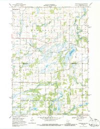
1968 Map of Princeton SW
USGS Topo · Published 1986About this map
The St Francis River and West Branch Rum River define the marshy lowland character of this central Minnesota landscape during the late 1960s. Large portions of the quadrangle are dedicated to conservation, notably the expansive Sherburne National Wildlife Refuge in the south and the Kunkel State Wildlife Management Area surrounding Rice Lake. This map captures a transition period where natural wetlands and prairie brooks were being managed through an extensive network of drainage projects, such as County Ditch No 6 and County Ditch No 3. For local historians and genealogists, the placement of the Greenbush Cem and the central Townhall provide essential reference points for the rural township of Greenbush. The presence of several Gravel Pits and a cross-country Pipeline indicate the light industrial and infrastructure developments supporting the local economy alongside these protected natural areas.
Find a feature on this map
19 named features on this map. Tap any name to fly to it.
Don’t see what you’re looking for? This feature index may not catch every label — zoom into the map to look around manually.
Map Details
Editions of this 1968 Princeton SW Map
2 editions found
Other maps of this area

1953 · Stillwater
USGS Topo · 1:250,000

1955 · Stillwater
USGS Topo · 1:250,000

1958 · Stillwater
USGS Topo · 1:250,000

1961 · Orrock
USGS Topo · 1:24,000

1961 · Lake Fremont
USGS Topo · 1:24,000

1961 · Becker
USGS Topo · 1:24,000

1961 · Monticello
USGS Topo · 1:62,500

1961 · Elk River
USGS Topo · 1:62,500

1965 · Stillwater
USGS Topo · 1:250,000
1968 · Santiago
USGS Topo · 1:24,000
Featured Places
- Blue Hill Township, MN
- Greenbush Township, MN
- Baldwin Township, MN
- Princeton Township, MN
- Sherburne County, MN