
1961 Map of Monticello
USGS Topo · Published 1965About this map
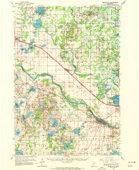
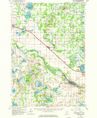
The Mississippi River cuts a wide path through the center of this landscape, separating Sherburne County to the north from Wright County to the south. Along its banks and the parallel tracks of the Great Northern and Northern Pacific railroads, settlements like Monticello, Becker, and Clear Lake serve as hubs for a region defined by its glacial lakes and transition from timber to agriculture. The map detail highlights the dense concentration of water bodies south of the river, including Maria Lake, Eagle Lake, and Bertram Lake, which contrast with the more open terrain found near Salida and Enfield. Local life is anchored by rural institutions such as Carter Sch and the Snake River Ch, while the numerous graveyards like St Henrys Cem and Danish Cem provide vital reference points for genealogical research in these lakeside townships.
Find a feature on this map
89 named features on this map. Tap any name to fly to it.
Don’t see what you’re looking for? This feature index may not catch every label — zoom into the map to look around manually.
Map Details
Editions of this 1961 Monticello Map
3 editions found
Other maps of this area

1909 · Rockford
USGS Topo · 1:62,500

1950 · St. Cloud
USGS Topo · 1:62,500

1951 · Annandale
USGS Topo · 1:62,500

1953 · Saint Cloud
USGS Topo · 1:250,000

1953 · Stillwater
USGS Topo · 1:250,000

1955 · Stillwater
USGS Topo · 1:250,000

1957 · Saint Cloud
USGS Topo · 1:250,000

1958 · Stillwater
USGS Topo · 1:250,000

1958 · Saint Cloud
USGS Topo · 1:250,000

1958 · Rockford
USGS Topo · 1:62,500