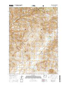
2014 Map of Pringle Flat
USGS Topo · Published 2014About this map
Ochoco National Forest defines this high-desert landscape in Crook County, where the terrain transitions from forested ridges to the open expanse of Pringle Flat. This 2014 survey documents a network of seasonal water management features essential for ranching and forest health, including Klootchman Cr Reservoir and the Pringle Flat Reservoir. The drainage patterns are clearly marked by the winding courses of Soldier Cr, Ant Cr, and Bear Cr, illustrating the hydrology of the Ochoco Mountains' southern slopes. Improved roads like SE Roberts Rd and SE Klootchman Creek Rd provide the primary access into these remote reaches, which are also serviced by smaller reservoirs like Rickmans Camp Cr Reservoir Number Two. For researchers, the map provides a contemporary view of public land management and the enduring importance of water resources in Oregon's interior.
Find a feature on this map
16 named features on this map. Tap any name to fly to it.
Don’t see what you’re looking for? This feature index may not catch every label — zoom into the map to look around manually.
Map Details
Editions of this 2014 Pringle Flat Map
This is the sole edition of this map. No revisions or reprints were ever made.
Other maps of this area

1946 · Eagle Rock
USGS Topo · 1:62,500

1948 · Eagle Rock
USGS Topo · 1:62,500

1951 · Post
USGS Topo · 1:62,500

1955 · Crescent
USGS Topo · 1:250,000

1955 · Bend
USGS Topo · 1:250,000

1957 · Crescent
USGS Topo · 1:250,000

1957 · Bend
USGS Topo · 1:250,000

1958 · Crescent
USGS Topo · 1:250,000

1958 · Bend
USGS Topo · 1:250,000
1967 · Sugarloaf Butte
USGS Topo · 1:24,000