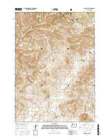
2017 Map of Pringle Flat
USGS Topo · Published 2017About this map
Ochoco National Forest dominates the northern reaches of this Crook County landscape, where the high desert terrain transitions into timbered slopes. The map details a complex network of forest and ranching roads, including SE Bear Creek Rd and Pringle Flat Rd, which navigate the drainage basins of Bear Cr and its various tributaries. Water management is central to the land's utility, evidenced by several catchments such as Klootchman Cr Reservoir and Rickmans Camp Cr Reservoir Number Two. To the south, the expansive Pringle Flat opens up, punctuated by the distinct rise of Juniper Butte. This area illustrates the late-20th-century character of Oregon's interior, where remote forest service lands meet established grazing flats and essential seasonal waterways like Ant Cr and W Fork Camp Cr.
Find a feature on this map
23 named features on this map. Tap any name to fly to it.
Don’t see what you’re looking for? This feature index may not catch every label — zoom into the map to look around manually.
Map Details
Editions of this 2017 Pringle Flat Map
This is the sole edition of this map. No revisions or reprints were ever made.
Other maps of this area

1946 · Eagle Rock
USGS Topo · 1:62,500

1948 · Eagle Rock
USGS Topo · 1:62,500

1951 · Post
USGS Topo · 1:62,500

1955 · Crescent
USGS Topo · 1:250,000

1955 · Bend
USGS Topo · 1:250,000

1957 · Crescent
USGS Topo · 1:250,000

1957 · Bend
USGS Topo · 1:250,000

1958 · Crescent
USGS Topo · 1:250,000

1958 · Bend
USGS Topo · 1:250,000
1967 · Sugarloaf Butte
USGS Topo · 1:24,000