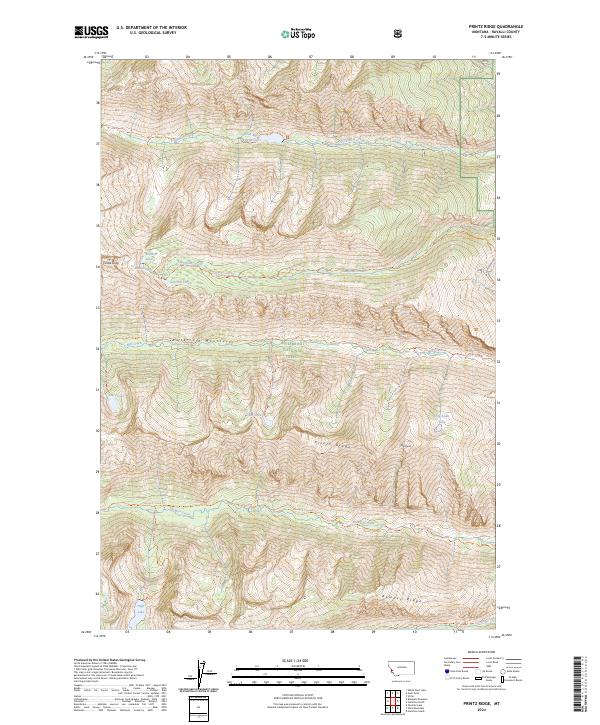
2024 Map of Printz Ridge
USGS Topo · Published 2024About this map
The Bitterroot Mountains dominate this high-elevation landscape within the Bitterroot National Forest. Defined by steep drainages and prominent peaks, the terrain is shaped by the headwaters of numerous waterways, including Fred Burr Creek and Blodgett Creek. The northern portion of the map is notable for the Fred Burr Reservoir, an engineered water body in an otherwise wilderness-heavy setting. Much of the western territory is protected as part of the Selway-Bitterroot Wilderness, where namesake features like Castle Crag and Printz Ridge suggest a landscape largely inaccessible except by the established network of trails. A series of high-altitude lakes, such as Knaack Lake, Sears Lake, and High Lake, dot the cirques at the top of these mountain valleys, providing a look at the hydrography of Ravalli County in the early twenty-first century.
Find a feature on this map
38 named features on this map. Tap any name to fly to it.
Don’t see what you’re looking for? This feature index may not catch every label — zoom into the map to look around manually.
Map Details
Editions of this 2024 Printz Ridge Map
This is the sole edition of this map. No revisions or reprints were ever made.
Other maps of this area

1901 · Hamilton
USGS Topo · 1:125,000

1956 · Hamilton
USGS Topo · 1:250,000

1959 · Hamilton
USGS Topo · 1:250,000

1960 · Hamilton
USGS Topo · 1:250,000

1964 · Hamilton
USGS Topo · 1:250,000

1964 · Hamilton South
USGS Topo · 1:24,000

1964 · Tenmile Lake
USGS Topo · 1:24,000

1964 · Ward Mountain
USGS Topo · 1:24,000
1966 · Blodgett Mtn
USGS Topo · 1:24,000
1966 · White Sand Lake
USGS Topo · 1:24,000