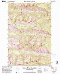
1998 Map of Printz Ridge
USGS Topo · Published 2002About this map
Printz Ridge and Romney Ridge dominate this high-elevation landscape within the Bitterroot range during the late 1990s. The area is defined by its dramatic relief and alpine hydrology, featuring a network of glacial lakes including Knaack Lake, Michele Lake, and Gerrard Lake tucked beneath the heights of Castle Crag. The cartography emphasizes the protected status of the land, with the Bitterroot National Forest and the Selway-Bitterroot Wilderness overlapping across the drainage basins of Fred Burr Creek and Sheafman Creek. Of particular interest is the Fred Burr Reservoir, an engineered water feature situated deep within the wilderness boundaries. This 1998 revision provides a clear view of the mountain terrain before later environmental shifts, documenting the precise locations of landmarks like Mill Point and Tag Alder Lake.
Find a feature on this map
22 named features on this map. Tap any name to fly to it.
Don’t see what you’re looking for? This feature index may not catch every label — zoom into the map to look around manually.
Map Details
Editions of this 1998 Printz Ridge Map
This is the sole edition of this map. No revisions or reprints were ever made.
Other maps of this area

1901 · Hamilton
USGS Topo · 1:125,000

1956 · Hamilton
USGS Topo · 1:250,000

1959 · Hamilton
USGS Topo · 1:250,000

1960 · Hamilton
USGS Topo · 1:250,000

1964 · Hamilton
USGS Topo · 1:250,000

1964 · Hamilton South
USGS Topo · 1:24,000

1964 · Tenmile Lake
USGS Topo · 1:24,000

1964 · Ward Mountain
USGS Topo · 1:24,000
1966 · Blodgett Mtn
USGS Topo · 1:24,000
1966 · White Sand Lake
USGS Topo · 1:24,000