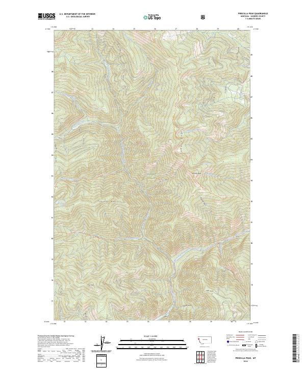
2024 Map of Priscilla Peak
USGS Topo · Published 2024About this map
Priscilla Peak stands as the central landmark in this high-altitude reach of the Lolo National Forest, where the complex drainage systems of the Cabinet Mountains converge. The Thompson River and its major tributaries, including the West Fork Thompson River and North Fork Four Lakes Creek, carve deep drainages through the terrain. Evidence of the region's wilderness management is seen in the network of established paths like the Sundance Ridge Trl and Honeymoon Creek Trl, which provide access to remote water bodies such as Honeymoon Lake. The landscape is characterized by sharp elevation changes between summits like Liver Peak and the low-lying Herron Rapids, illustrating the steep vertical relief typical of the Sanders County backcountry.
Find a feature on this map
48 named features on this map. Tap any name to fly to it.
Don’t see what you’re looking for? This feature index may not catch every label — zoom into the map to look around manually.
Map Details
Editions of this 2024 Priscilla Peak Map
This is the sole edition of this map. No revisions or reprints were ever made.
Other maps of this area

1937 · Thompson Falls
USGS Topo · 1:125,000

1937 · Thompson Falls
USGS Topo · 1:62,500

1956 · Wallace
USGS Topo · 1:250,000

1957 · Thompson Falls
USGS Topo · 1:62,500

1960 · Wallace
USGS Topo · 1:250,000

1964 · Calico Creek
USGS Topo · 1:24,000

1964 · Eddy Mountain
USGS Topo · 1:24,000
1964 · Big Hole Peak
USGS Topo · 1:24,000
1964 · Priscilla Peak
USGS Topo · 1:24,000

1966 · Vermilion Peak
USGS Topo · 1:24,000