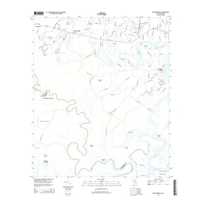
2014 Map of Pritchardville
USGS Topo · Published 2014About this map
Pritchardville and the winding reaches of the May River define this coastal South Carolina landscape, where tidal creeks and marshlands create a complex geography of named islands and landings. The map reveals a transition from traditional rural landings like Good Hope Landing and Glasgow Landing to the developing residential corridors along Buckwalter PKY and May River RD. Genealogists will find a high density of burial sites including Moreland Cem, Shad Cem, and the Cook Landing Cem, which anchor the local history of families settled along the New River. The southern edge of the survey captures the northern tip of Daufuskie Island and the critical maritime artery of the Intracoastal Waterway, illustrating the enduring importance of water-based travel and industry in the Lowcountry during the early 21st century.
Find a feature on this map
118 named features on this map. Tap any name to fly to it.
Don’t see what you’re looking for? This feature index may not catch every label — zoom into the map to look around manually.
Map Details
Editions of this 2014 Pritchardville Map
This is the sole edition of this map. No revisions or reprints were ever made.
Other maps of this area

1920 · Hardeeville
USGS Topo · 1:62,500

1920 · Okatie
USGS Topo · 1:62,500

1920 · Bluffton
USGS Topo · 1:62,500

1942 · Savannah
USGS Topo · 1:62,500

1942 · Okatie
USGS Topo · 1:62,500

1943 · Hardeeville
USGS Topo · 1:62,500

1945 · Bluffton
USGS Topo · 1:62,500

1947 · Savannah
USGS Topo · 1:250,000

1948 · Savannah
USGS Topo · 1:250,000

1953 · Hardeeville
USGS Topo · 1:62,500