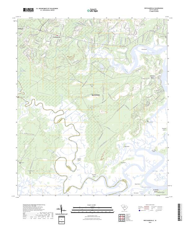
2024 Map of Pritchardville
USGS Topo · Published 2024About this map
The May River and the New River define this coastal landscape near the Beaufort Co Jasper Co line, where inland swamps transition into a complex network of islands and tidal creeks. The historic town of Bluffton serves as a central hub, surrounded by newer developments and established plantations like Palmetto Bluff. Notable for genealogists, the map identifies several distinct burial grounds, including Cummingsville Cem and Moreland Cem, which reflect the area's long history of settlement.
Find a feature on this map
40 named features on this map. Tap any name to fly to it.
Don’t see what you’re looking for? This feature index may not catch every label — zoom into the map to look around manually.
Map Details
Editions of this 2024 Pritchardville Map
This is the sole edition of this map. No revisions or reprints were ever made.
Other maps of this area

1920 · Hardeeville
USGS Topo · 1:62,500

1920 · Okatie
USGS Topo · 1:62,500

1920 · Bluffton
USGS Topo · 1:62,500

1942 · Savannah
USGS Topo · 1:62,500

1942 · Okatie
USGS Topo · 1:62,500

1943 · Hardeeville
USGS Topo · 1:62,500

1945 · Bluffton
USGS Topo · 1:62,500

1947 · Savannah
USGS Topo · 1:250,000

1948 · Savannah
USGS Topo · 1:250,000

1953 · Hardeeville
USGS Topo · 1:62,500