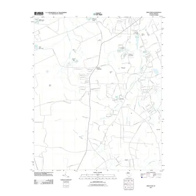
2011 Map of Privateer
USGS Topo · Published 2011About this map
The low-lying coastal plain of Sumter County is defined by a complex network of wetlands and small impoundments near Privateer. A series of water-management features, including Cains Mill Pond Dam and Shuler Pond Dam, speak to the historical reliance on controlled waterways. The landscape transitions from the higher Sand Hills in the west toward the dense vegetation of Manchester State Forest, with numerous "bays" and branches typical of the South Carolina Midlands.
Find a feature on this map
131 named features on this map. Tap any name to fly to it.
Don’t see what you’re looking for? This feature index may not catch every label — zoom into the map to look around manually.
Map Details
Editions of this 2011 Privateer Map
This is the sole edition of this map. No revisions or reprints were ever made.
Other maps of this area

1943 · Eastover
USGS Topo · 1:62,500

1946 · Elloree
USGS Topo · 1:62,500

1946 · Sumter
USGS Topo · 1:62,500

1953 · Poinsett State Park
USGS Topo · 1:24,000

1953 · Wedgefield
USGS Topo · 1:24,000

1954 · Augusta
USGS Topo · 1:250,000

1957 · Sumter East
USGS Topo · 1:24,000

1957 · Sumter West
USGS Topo · 1:24,000

1957 · Sumter
USGS Topo · 1:62,500

1957 · Augusta
USGS Topo · 1:250,000