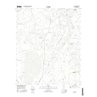
2017 Map of Privateer
USGS Topo · Published 2017About this map
Brunson Swamp and Sammy Swamp define the low-lying hydrology of this landscape south of the city of Sumter. The community of Privateer serves as a central hub, surrounded by a complex network of residential roads and agricultural land. Significant water features including Cain Millpond, Stubbs Pond, and Jones Pond reflect a history of local water management and milling, while the Sand Hills terrain to the west offers a distinct contrast to the eastern wetlands. Cultural and genealogical markers are well-represented by Smith Cem, Reynolds Cem, and Hillside Memorial Park, providing clear points of reference for local family history research. The southern boundary marks the transition between Sumter Co and Clarendon Co, following the winding path of Broadway Br.
Find a feature on this map
115 named features on this map. Tap any name to fly to it.
Don’t see what you’re looking for? This feature index may not catch every label — zoom into the map to look around manually.
Map Details
Editions of this 2017 Privateer Map
This is the sole edition of this map. No revisions or reprints were ever made.
Other maps of this area

1943 · Eastover
USGS Topo · 1:62,500

1946 · Elloree
USGS Topo · 1:62,500

1946 · Sumter
USGS Topo · 1:62,500

1953 · Poinsett State Park
USGS Topo · 1:24,000

1953 · Wedgefield
USGS Topo · 1:24,000

1954 · Augusta
USGS Topo · 1:250,000

1957 · Sumter East
USGS Topo · 1:24,000

1957 · Sumter West
USGS Topo · 1:24,000

1957 · Sumter
USGS Topo · 1:62,500

1957 · Augusta
USGS Topo · 1:250,000