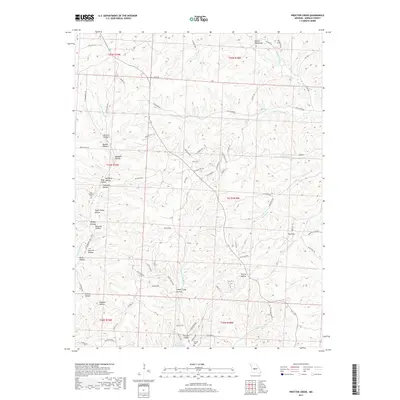
2017 Map of Proctor Creek
USGS Topo · Published 2017About this map
Proctor Hollow and the southern reaches of the Lake of the Ozarks define this landscape in Morgan County, where the terrain is deeply etched by a network of creeks and named hollows. The drainage patterns of Little Buffalo Cr, Locust Cr, and Brushy Cr illustrate the complex topography of the Ozark Plateau. Cultural markers such as the Ard-Menteer Cem and Proctor Cem provide specific points of interest for genealogists, while the small settlement at Phils Acres represents modern residential footprints. The naming of features like Sugar Camp Hollow and Sawmill Hollow points to the area's historical reliance on timber and local land-based industries. Significant landmarks such as the Devils Backbone ridge further emphasize the geographic character of the region during the early 21st century.
Find a feature on this map
87 named features on this map. Tap any name to fly to it.
Don’t see what you’re looking for? This feature index may not catch every label — zoom into the map to look around manually.
Map Details
Editions of this 2017 Proctor Creek Map
This is the sole edition of this map. No revisions or reprints were ever made.
Other maps of this area

1887 · Warsaw
USGS Topo · 1:125,000

1888 · Versailles
USGS Topo · 1:125,000

1893 · Versailles
USGS Topo · 1:125,000

1894 · Warsaw
USGS Topo · 1:125,000

1904 · Gravois Mills
USGS Topo · 1:62,500

1934 · Purvis
USGS Topo · 1:24,000

1934 · Irontown Ferry
USGS Topo · 1:24,000

1935 · Gravois Mills
USGS Topo · 1:24,000

1935 · Proctor Creek
USGS Topo · 1:24,000

1935 · Boylers Mill
USGS Topo · 1:24,000