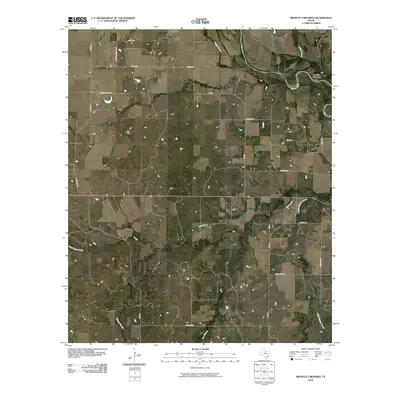
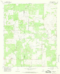
2010 Map of Proffitt Crossing
USGS Topo · Published 2010About this map
Proffitt Crossing serves as the focal point for this rural landscape in Young County, where the Brazos River winds through North Texas cattle country. The terrain is defined by an intricate network of waterways, including Elm Creek and Cribb Station Creek, that feed into the Brazos. This 2010 topographic record captures the area's transition into the 21st century, showing a mix of established farm-to-market roads and local routes that hint at the region's ranching heritage. Local history is etched into the names of many thoroughfares, such as Elbert Cemetery Rd and Mexican Spring Rd, reflecting old family ties and water sources that supported early settlers. Away from the riverbanks, smaller drainages like Bush Knob Creek and Boggy Creek carve subtle variations into the landscape, illustrating the hydrology of this semi-arid region.
Find a feature on this map
28 named features on this map. Tap any name to fly to it.
Don’t see what you’re looking for? This feature index may not catch every label — zoom into the map to look around manually.
Map Details
Editions of this 2010 Proffitt Crossing Map
This is the sole edition of this map. No revisions or reprints were ever made.
Other maps of this area

1954 · Wichita Falls
USGS Topo · 1:250,000

1958 · Wichita Falls
USGS Topo · 1:250,000

1964 · Padgett
USGS Topo · 1:24,000

1964 · Olney
USGS Topo · 1:24,000

1965 · Throckmorton NE
USGS Topo · 1:24,000

1966 · Westover SE
USGS Topo · 1:24,000
1966 · Woodson
USGS Topo · 1:24,000
1966 · Proffitt
USGS Topo · 1:24,000
1966 · Tackett Mountain
USGS Topo · 1:24,000
1966 · Murray
USGS Topo · 1:24,000