
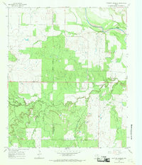
1965 Map of Throckmorton NE
USGS Topo · Published 1969About this map
Bush Knob rises above the rolling drainage basin of the Texas ranchlands in this mid-1960s survey. The landscape is defined by the winding paths of North Elm Creek, Elm Creek, and Bush Knob Creek, which dictate the local topography. Human influence on the land is marked by an extensive network of petroleum extraction, with numerous Oil Wells and Oil Well sites scattered throughout the territory. Evidence of former transportation infrastructure appears in the southwest corner where an Old RR Grade cuts across the terrain, indicating a bypass or removal of rail service by the time this map was field-checked in 1965. Local travelers along the state route would have found rest at the Roadside Park, a small island of public space amidst the private ranching and oil operations of the era.
Find a feature on this map
10 named features on this map. Tap any name to fly to it.
Don’t see what you’re looking for? This feature index may not catch every label — zoom into the map to look around manually.
Map Details
Editions of this 1965 Throckmorton NE Map
This is the sole edition of this map. No revisions or reprints were ever made.
Other maps of this area

1954 · Wichita Falls
USGS Topo · 1:250,000

1958 · Wichita Falls
USGS Topo · 1:250,000

1964 · Padgett
USGS Topo · 1:24,000

1966 · Westover SE
USGS Topo · 1:24,000
1966 · Woodson
USGS Topo · 1:24,000

1966 · Westover SW
USGS Topo · 1:24,000
1966 · Sibley Creek
USGS Topo · 1:24,000
1966 · Murray
USGS Topo · 1:24,000
1966 · Throckmorton
USGS Topo · 1:24,000
1966 · Proffitt Crossing
USGS Topo · 1:24,000