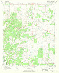
1966 Map of Sibley Creek
USGS Topo · Published 1969About this map
The Clear Fork Brazos River flows across the southwestern corner of this West Texas landscape, a region defined by its wide creek drainages and intermittent watercourses. In the mid-1960s, this area of Throckmorton County maintained a sparse settlement pattern anchored by the small community of Richards. The map reveals a land dedicated to resource extraction and ranching, dominated by an extensive Oil Field and numerous Oil Wells scattered across the undulating terrain.
Find a feature on this map
19 named features on this map. Tap any name to fly to it.
Don’t see what you’re looking for? This feature index may not catch every label — zoom into the map to look around manually.
Map Details
Editions of this 1966 Sibley Creek Map
2 editions found
Other maps of this area

1892 · Albany
USGS Topo · 1:125,000

1893 · Albany
USGS Topo · 1:125,000

1954 · Abilene
USGS Topo · 1:250,000

1954 · Wichita Falls
USGS Topo · 1:250,000

1958 · Wichita Falls
USGS Topo · 1:250,000

1958 · Abilene
USGS Topo · 1:250,000

1965 · Collins Creek
USGS Topo · 1:24,000

1965 · Lusk
USGS Topo · 1:24,000

1965 · Fort Griffin
USGS Topo · 1:24,000

1965 · Throckmorton NE
USGS Topo · 1:24,000