
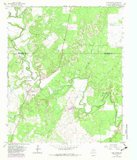
1965 Map of Fort Griffin
USGS Topo · Published 1967About this map
The Clear Fork Brazos River winds deeply through the heart of this landscape, marking the historical boundary between Shackelford and Throckmorton counties. The central focus of the sheet is Fort Griffin State Park, where the preserved ruins stand as a physical record of the 19th-century frontier outpost. The terrain is characterized by a dense network of watercourses, including Lambshead Creek, Collins Creek, and Murphy Creek, which have historically dictated the placement of roads and early ranching boundaries.
Find a feature on this map
18 named features on this map. Tap any name to fly to it.
Don’t see what you’re looking for? This feature index may not catch every label — zoom into the map to look around manually.
Map Details
Editions of this 1965 Fort Griffin Map
2 editions found
Other maps of this area

1892 · Albany
USGS Topo · 1:125,000

1893 · Albany
USGS Topo · 1:125,000

1954 · Abilene
USGS Topo · 1:250,000

1954 · Wichita Falls
USGS Topo · 1:250,000

1958 · Wichita Falls
USGS Topo · 1:250,000

1958 · Abilene
USGS Topo · 1:250,000

1958 · Edwards Branch
USGS Topo · 1:24,000

1965 · Collins Creek
USGS Topo · 1:24,000

1965 · Lusk
USGS Topo · 1:24,000
1965 · Murphy Creek
USGS Topo · 1:24,000