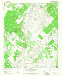
1965 Map of Murphy Creek
USGS Topo · Published 1967About this map
Hubbard Creek Reservoir dominates the southeastern corner of this mid-1960s survey, its shoreline defined by controlled inundation patterns that reach up to the 1192-foot elevation line. The surrounding Shackelford County landscape is a complex network of intermittent drainages, including Murphy Creek, Foyle Creek, and Newcomb Creek, which carve through the terrain. Evidence of the local extraction economy is visible throughout the quadrangle, with numerous Oil Wells and a Gravel Pit scattered across the rural acreage. Local history is anchored by a small, unnamed Cem and a Roadside Park along the southern highway, while fine red dashed lines throughout the map provide a unique look at the established fence lines and property divisions of the era. This document is particularly valuable for tracing the transformation of the land following the development of the reservoir.
Find a feature on this map
10 named features on this map. Tap any name to fly to it.
Don’t see what you’re looking for? This feature index may not catch every label — zoom into the map to look around manually.
Map Details
Editions of this 1965 Murphy Creek Map
2 editions found
Other maps of this area

1892 · Albany
USGS Topo · 1:125,000

1893 · Albany
USGS Topo · 1:125,000

1954 · Abilene
USGS Topo · 1:250,000

1958 · Abilene
USGS Topo · 1:250,000

1958 · Edwards Branch
USGS Topo · 1:24,000

1961 · Eolian
USGS Topo · 1:24,000

1965 · Collins Creek
USGS Topo · 1:24,000

1965 · Albany
USGS Topo · 1:24,000

1965 · McCatherine Mountain
USGS Topo · 1:24,000

1965 · Lusk
USGS Topo · 1:24,000