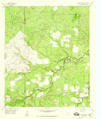
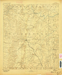
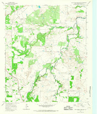
1958 Map of Edwards Branch
USGS Topo · Published 1959About this map
Hubbard Creek winds through this central Texas landscape, defining the rural character of the border between Shackelford and Stephens counties in the late 1950s. The terrain is a network of intermittent watercourses including Negro Creek, Mc Dowell Creek, and Black Branch, punctuated by the elevation of Flat Top. While the area remains largely undeveloped, it shows the clear imprint of mid-century industrial utility, with multiple Oil Wells and a Sludge Pit scattered across the plains. A distinct geographical feature known as The Island sits at a bend in the main creek, while the site of Graves indicates local family history or early pioneer burial grounds. The map also documents the infrastructure of the era, tracing a Pipeline and Telephone Line that cut across the open ranch land near Edwards Branch.
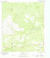
Find a feature on this map
19 named features on this map. Tap any name to fly to it.
Don’t see what you’re looking for? This feature index may not catch every label — zoom into the map to look around manually.
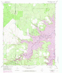
Map Details
Editions of this 1958 Edwards Branch Map
3 editions found
Other maps of this area
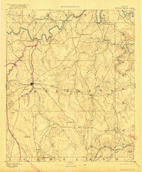
1890 · Breckenridge
USGS Topo · 1:125,000

1892 · Albany
USGS Topo · 1:125,000
1893 · Albany
USGS Topo · 1:125,000

1954 · Abilene
USGS Topo · 1:250,000

1958 · Abilene
USGS Topo · 1:250,000
1958 · Breckenridge
USGS Topo · 1:24,000
1961 · Buck Mountain
USGS Topo · 1:24,000
1961 · Eolian
USGS Topo · 1:24,000
1965 · McCatherine Mountain
USGS Topo · 1:24,000
1965 · Lusk
USGS Topo · 1:24,000