
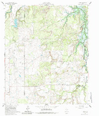
1961 Map of Eolian
USGS Topo · Published 1962About this map
Eolian sits at a geographic crossroads in Stephens County where the prairie transition begins to give way to more complex creek drainage systems. During the early 1960s, this landscape was defined by its water resources and legacy industrial sites, including the Mankins Mill (Site) and the extensive petroleum infrastructure of the Ibex Field. The map provides a detailed view of the regional topography before the full impact of modern reservoir expansion, showing De La Fosse Lake and the Spillway 1231 near the Shackelford County line.
Find a feature on this map
17 named features on this map. Tap any name to fly to it.
Don’t see what you’re looking for? This feature index may not catch every label — zoom into the map to look around manually.
Map Details
Editions of this 1961 Eolian Map
3 editions found
Other maps of this area

1890 · Breckenridge
USGS Topo · 1:125,000

1892 · Albany
USGS Topo · 1:125,000

1893 · Albany
USGS Topo · 1:125,000

1954 · Abilene
USGS Topo · 1:250,000

1958 · Abilene
USGS Topo · 1:250,000

1958 · Breckenridge
USGS Topo · 1:24,000

1958 · Edwards Branch
USGS Topo · 1:24,000

1961 · Buck Mountain
USGS Topo · 1:24,000

1965 · McCatherine Mountain
USGS Topo · 1:24,000
1965 · Murphy Creek
USGS Topo · 1:24,000