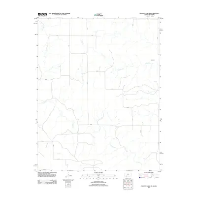
2012 Map of Proffitt Lake SW
USGS Topo · Published 2012About this map
Fivemile Cr and Crooked Cr wind through the high plains of the Oklahoma Panhandle, carving subtle drainage patterns across the arid landscape of Beaver County. This region is defined by a strict section-line road grid, where utilitarian routes like Z Rd and Aa Rd facilitate movement between scattered agricultural holdings. The map reveals the quiet infrastructure of rural life in the early 21st century, centered on these intermittent watercourses and the local heritage preserved at the Butler Cem in the northeastern quadrant. The landscape reflects a modern era of precision land management, where the ancient paths of the creeks provide the only deviation from the geometric precision of the county roads and ranch boundaries.
Find a feature on this map
19 named features on this map. Tap any name to fly to it.
Don’t see what you’re looking for? This feature index may not catch every label — zoom into the map to look around manually.
Map Details
Editions of this 2012 Proffitt Lake SW Map
This is the sole edition of this map. No revisions or reprints were ever made.
Other maps of this area

1892 · Meade
USGS Topo · 1:125,000

1954 · Perryton
USGS Topo · 1:250,000

1955 · Dodge City
USGS Topo · 1:250,000

1958 · Perryton
USGS Topo · 1:250,000

1958 · Dodge City
USGS Topo · 1:250,000

1959 · Dodge City
USGS Topo · 1:250,000

1962 · Irish Flats NE
USGS Topo · 1:24,000

1962 · Irish Flats SE
USGS Topo · 1:24,000
1970 · Gate NE
USGS Topo · 1:24,000

1970 · Gate NW
USGS Topo · 1:24,000