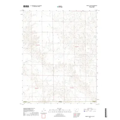
2018 Map of Proffitt Lake SW
USGS Topo · Published 2018About this map
Kansas and Oklahoma meet along the southern boundary of this 2018 survey, which documents the high plains landscape where Meade County joins Beaver County. The terrain is defined by the winding drainages of Fivemile Cr in the northeast and Crooked Cr further south, cutting through the sectioned agricultural grid. A notable site for local researchers is the Butler Cem, located just north of the state line in the eastern portion of the quadrangle. The map details a strictly organized rural infrastructure, with a network of alphabetical roads such as Z RD, Aa RD, and Ee RD providing access to the vast ranching and farming tracts. This modern topographic record captures the enduring isolation and the precise geopolitical divisions of the Cimarron River watershed region.
Find a feature on this map
16 named features on this map. Tap any name to fly to it.
Don’t see what you’re looking for? This feature index may not catch every label — zoom into the map to look around manually.
Map Details
Editions of this 2018 Proffitt Lake SW Map
This is the sole edition of this map. No revisions or reprints were ever made.
Other maps of this area

1892 · Meade
USGS Topo · 1:125,000

1954 · Perryton
USGS Topo · 1:250,000

1955 · Dodge City
USGS Topo · 1:250,000

1958 · Perryton
USGS Topo · 1:250,000

1958 · Dodge City
USGS Topo · 1:250,000

1959 · Dodge City
USGS Topo · 1:250,000

1962 · Irish Flats NE
USGS Topo · 1:24,000

1962 · Irish Flats SE
USGS Topo · 1:24,000
1970 · Gate NE
USGS Topo · 1:24,000

1970 · Gate NW
USGS Topo · 1:24,000