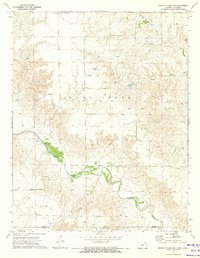
1972 Map of Proffitt Lake SW
USGS Topo · Published 1974About this map
The Kansas Oklahoma border bisects this 1970s landscape, where the high plains of Meade County and Beaver County are deeply incised by the meandering path of Crooked Creek. The terrain reveals a transition from flat tablelands to complex drainage patterns, supporting an economy driven by energy extraction as evidenced by numerous Gas Wells and an Oil Well scattered throughout the quadrangle. Significant infrastructure including a Pipeline and the Painter Landing Strip suggests a mid-century period of regional development and industrial activity.
Find a feature on this map
15 named features on this map. Tap any name to fly to it.
Don’t see what you’re looking for? This feature index may not catch every label — zoom into the map to look around manually.
Map Details
Editions of this 1972 Proffitt Lake SW Map
This is the sole edition of this map. No revisions or reprints were ever made.
Other maps of this area

1892 · Meade
USGS Topo · 1:125,000

1954 · Perryton
USGS Topo · 1:250,000

1955 · Dodge City
USGS Topo · 1:250,000

1958 · Perryton
USGS Topo · 1:250,000

1958 · Dodge City
USGS Topo · 1:250,000

1959 · Dodge City
USGS Topo · 1:250,000

1962 · Irish Flats NE
USGS Topo · 1:24,000

1962 · Irish Flats SE
USGS Topo · 1:24,000
1970 · Gate NE
USGS Topo · 1:24,000

1970 · Gate NW
USGS Topo · 1:24,000