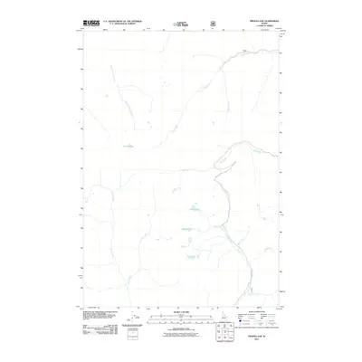
2011 Map of Profile Gap
USGS Topo · Published 2011About this map
Profile Lake and its surrounding drainages characterize this high-altitude Valley County landscape as it was documented in 2011. The terrain is defined by a dense network of alpine water bodies, including Crater Lake, Middle Lake, and Fish Lake, which feed the many creeks flowing through the area. Primitive transportation routes like Big Creek Rd provide the only major access through this territory, tracing the path of Profile Creek toward its confluence with Big Creek. The map reveals a complex system of named tributaries, such as Logan Creek, Vein Creek, and Quartz Creek, which suggest the mineral-rich history of the region and provide a detailed study of the hydrological patterns at the headwaters of the Salmon River watershed.
Find a feature on this map
17 named features on this map. Tap any name to fly to it.
Don’t see what you’re looking for? This feature index may not catch every label — zoom into the map to look around manually.
Map Details
Editions of this 2011 Profile Gap Map
This is the sole edition of this map. No revisions or reprints were ever made.
Other maps of this area

1937 · Yellow Pine
USGS Topo · 1:48,000

1937 · Big Creek
USGS Topo · 1:48,000

1942 · Big Creek
USGS Topo · 1:62,500

1943 · Yellow Pine
USGS Topo · 1:62,500

1956 · Elk City
USGS Topo · 1:250,000

1957 · Challis
USGS Topo · 1:250,000

1960 · Elk City
USGS Topo · 1:250,000

1960 · Challis
USGS Topo · 1:250,000

1963 · Challis
USGS Topo · 1:250,000

1969 · Edwardsburg
USGS Topo · 1:24,000