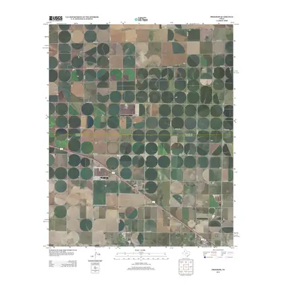
2012 Map of Progress
USGS Topo · Published 2012About this map
Progress is a small High Plains settlement defined by its grid of residential streets including 6th St and 3rd St, located where the diagonal passage of U.S. Route 70 and 84 intersects the rigid section-line road network of Bailey County. The landscape is a textbook example of rural Texas agricultural planning, where numbered county roads like Co Rd-133 and Co Rd-123 form a precise lattice across the terrain. Significant local landmarks include the Muleshoe Cem and the Bailey County Memorial Park, which serve as focal points for the surrounding community. This survey provides a clear view of the transition between the concentrated town site and the vast reaches of the Llano Estacado, linked by vital regional arteries such as Farm-To-Market Road 3125.
Find a feature on this map
35 named features on this map. Tap any name to fly to it.
Don’t see what you’re looking for? This feature index may not catch every label — zoom into the map to look around manually.
Map Details
Editions of this 2012 Progress Map
This is the sole edition of this map. No revisions or reprints were ever made.
Other maps of this area

1954 · Clovis
USGS Topo · 1:250,000

1958 · Clovis
USGS Topo · 1:250,000

1962 · Muleshoe
USGS Topo · 1:24,000

1962 · Birdwell Ranch
USGS Topo · 1:24,000

1962 · Baileyboro NE
USGS Topo · 1:24,000

1963 · Lariat
USGS Topo · 1:24,000

1963 · Clays Corner
USGS Topo · 1:24,000

1963 · Oklahoma Lane
USGS Topo · 1:24,000

1963 · Lariat NE
USGS Topo · 1:24,000

1963 · Lazbuddie SW
USGS Topo · 1:24,000