
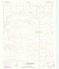
1962 Map of Birdwell Ranch
USGS Topo · Published 1965About this map
Birdwell Ranch stands as a focal point in this 1962 aerial photogrammetric study of the West Texas High Plains. The landscape is defined by the shallow, ephemeral course of Blackwater Draw, which meanders through a region primarily dedicated to agricultural and ranching interests. This era of mapping shows a high density of ground-water extraction points, marked simply as Well, indicating the intense reliance on the Ogallala Aquifer for rural operations. Transportation in this part of Bailey County is minimal, consisting of a few straight-line section roads and a rugged Jeep Trail cutting across the sandy terrain. Apart from the central ranch headquarters and scattered Gravel Pits, the map reveals a sparsely populated, functional landscape focused on resource management and cattle before modern industrial expansion shifted local land use.
Find a feature on this map
5 named features on this map. Tap any name to fly to it.
Don’t see what you’re looking for? This feature index may not catch every label — zoom into the map to look around manually.
Map Details
Editions of this 1962 Birdwell Ranch Map
2 editions found
Other maps of this area

1954 · Clovis
USGS Topo · 1:250,000

1957 · Clovis
USGS Topo · 1:62,500

1957 · Arch
USGS Topo · 1:62,500

1958 · Clovis
USGS Topo · 1:250,000

1962 · Stegall
USGS Topo · 1:24,000

1962 · Baileyboro NE
USGS Topo · 1:24,000

1962 · Baileyboro
USGS Topo · 1:24,000

1963 · Lariat
USGS Topo · 1:24,000

1963 · Progress
USGS Topo · 1:24,000

1985 · Pleasure Lake
USGS Topo · 1:24,000