
1962 Map of Stegall
USGS Topo · Published 1965About this map
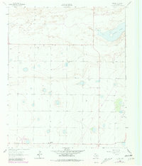
Stegall anchors the southern portion of this 1962 landscape in Bailey County, representing a modest hub in an area defined by agricultural development and natural depressions. The High Plains terrain is notably punctuated by Coyote Lake in the northeast, a prominent alkaline basin that serves as a focal point for the surrounding topography. The survey reveals a sparse but deliberate network of human activity, where numerous wells and several instances of a Gravel Pit indicate the local reliance on groundwater and geological resources. Fine red dashed lines throughout the sheet delineate selected fence lines, tracing the boundaries of large ranching and farming tracts that dominated the region during the early 1960s. This map provides a clear record of the rural infrastructure at a time when the West Texas landscape was being systematically organized by industrial and agricultural interests.
Find a feature on this map
4 named features on this map. Tap any name to fly to it.
Don’t see what you’re looking for? This feature index may not catch every label — zoom into the map to look around manually.
Map Details
Editions of this 1962 Stegall Map
2 editions found
Other maps of this area

1954 · Clovis
USGS Topo · 1:250,000

1954 · Brownfield
USGS Topo · 1:250,000

1957 · Arch
USGS Topo · 1:62,500

1958 · Brownfield
USGS Topo · 1:250,000

1958 · Clovis
USGS Topo · 1:250,000

1962 · Brownfield
USGS Topo · 1:250,000

1962 · Birdwell Ranch
USGS Topo · 1:24,000

1962 · Baileyboro NE
USGS Topo · 1:24,000

1962 · Baileyboro
USGS Topo · 1:24,000

1968 · Three Way School
USGS Topo · 1:24,000