
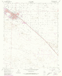
1962 Map of Muleshoe
USGS Topo · Published 1965About this map
Muleshoe stands as a busy agricultural and transportation hub on the High Plains, oriented along the Panhandle and Santa Fe railroad line. The town's grid is well-established by the early 1960s, featuring a concentrated residential area supported by several institutions including the Richland Hills Sch, Mary De Shazo Sch, and a dedicated Jr High Sch. Cultural and recreational life is evidenced by the Drive-in Theater and the Golf Course located near Warren Airfield on the northeastern edge of the settlement.
Find a feature on this map
44 named features on this map. Tap any name to fly to it.
Don’t see what you’re looking for? This feature index may not catch every label — zoom into the map to look around manually.
Map Details
Editions of this 1962 Muleshoe Map
2 editions found
Other maps of this area

1954 · Clovis
USGS Topo · 1:250,000

1958 · Clovis
USGS Topo · 1:250,000

1962 · Needmore
USGS Topo · 1:24,000

1962 · Baileyboro NE
USGS Topo · 1:24,000

1962 · Baileyboro
USGS Topo · 1:24,000

1962 · Sudan
USGS Topo · 1:24,000

1962 · Muleshoe NE
USGS Topo · 1:24,000

1963 · Lazbuddie SW
USGS Topo · 1:24,000

1963 · Progress
USGS Topo · 1:24,000
1963 · Lazbuddie SE
USGS Topo · 1:24,000