
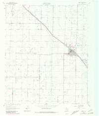
1962 Map of Sudan
USGS Topo · Published 1965About this map
Agricultural water management and the infrastructure of the High Plains dominate this 1960s study of the South Plains region. The town of Sudan sits as the primary hub of activity, oriented along the Panhandle and Santa Fe railroad line. This diagonal rail corridor dictates the town's grid and connects it to the smaller community of Fairview to the northwest. Beyond the residential clusters, the landscape is defined by an intensive network of water wells, reflecting the era's heavy reliance on irrigation for cotton and grain farming.
Find a feature on this map
10 named features on this map. Tap any name to fly to it.
Don’t see what you’re looking for? This feature index may not catch every label — zoom into the map to look around manually.
Map Details
Editions of this 1962 Sudan Map
2 editions found
Other maps of this area

1954 · Clovis
USGS Topo · 1:250,000

1954 · Brownfield
USGS Topo · 1:250,000

1958 · Brownfield
USGS Topo · 1:250,000

1958 · Clovis
USGS Topo · 1:250,000

1962 · Brownfield
USGS Topo · 1:250,000

1962 · Muleshoe
USGS Topo · 1:24,000

1962 · Needmore
USGS Topo · 1:24,000

1962 · Amherst
USGS Topo · 1:24,000

1962 · Muleshoe NE
USGS Topo · 1:24,000

1963 · Earth
USGS Topo · 1:24,000