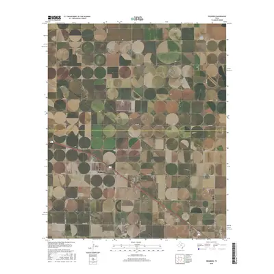
2016 Map of Progress
USGS Topo · Published 2016About this map
The agricultural plains of the Texas Panhandle define this 2016 survey, centered on the settlement of Progress. Located near the Parmer Co Bailey Co line, the area is characterized by a dense grid of rural roads and the intermittent drainage of Progress Draw. The landscape shows a clear transition from the open ranch and farm land of the north, marked by Co RD Aa and Co RD BB, to the more developed transport corridor in the south where U.S. Route 84 and local routes like W Camp Rd converge. For those tracing local families, the map identifies two significant burial grounds: Bailey County Cem and Muleshoe Memorial Park Cem. The detailed road network, including residential streets like Apple St and 8th St, provides a clear view of the community's layout in the mid-2010s.
Find a feature on this map
34 named features on this map. Tap any name to fly to it.
Don’t see what you’re looking for? This feature index may not catch every label — zoom into the map to look around manually.
Map Details
Editions of this 2016 Progress Map
This is the sole edition of this map. No revisions or reprints were ever made.
Other maps of this area

1954 · Clovis
USGS Topo · 1:250,000

1958 · Clovis
USGS Topo · 1:250,000

1962 · Muleshoe
USGS Topo · 1:24,000

1962 · Birdwell Ranch
USGS Topo · 1:24,000

1962 · Baileyboro NE
USGS Topo · 1:24,000

1963 · Lariat
USGS Topo · 1:24,000

1963 · Clays Corner
USGS Topo · 1:24,000

1963 · Oklahoma Lane
USGS Topo · 1:24,000

1963 · Lariat NE
USGS Topo · 1:24,000

1963 · Lazbuddie SW
USGS Topo · 1:24,000