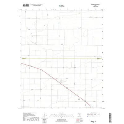
2019 Map of Progress
USGS Topo · Published 2019About this map
Progress sits at a crossroads in the High Plains of the Texas Panhandle, positioned along the border between Parmer Co and Bailey Co. This agricultural landscape is defined by a rigorous grid of section roads and the diagonal passage of a primary highway route. The natural topography is subtle, highlighted by the shallow depression of Progress Draw which cuts across the northwest corner of the map. Local history is anchored by the presence of Bailey County Cem and the Muleshoe Memorial Park Cem, providing significant points of interest for genealogical research in this rural expanse. The map illustrates a high degree of connectivity through a dense network of county roads like Co RD 1008 and farm-to-market routes, including FM 2079 and FM 3125.
Find a feature on this map
34 named features on this map. Tap any name to fly to it.
Don’t see what you’re looking for? This feature index may not catch every label — zoom into the map to look around manually.
Map Details
Editions of this 2019 Progress Map
This is the sole edition of this map. No revisions or reprints were ever made.
Other maps of this area

1954 · Clovis
USGS Topo · 1:250,000

1958 · Clovis
USGS Topo · 1:250,000

1962 · Muleshoe
USGS Topo · 1:24,000

1962 · Birdwell Ranch
USGS Topo · 1:24,000

1962 · Baileyboro NE
USGS Topo · 1:24,000

1963 · Lariat
USGS Topo · 1:24,000

1963 · Clays Corner
USGS Topo · 1:24,000

1963 · Oklahoma Lane
USGS Topo · 1:24,000

1963 · Lariat NE
USGS Topo · 1:24,000

1963 · Lazbuddie SW
USGS Topo · 1:24,000