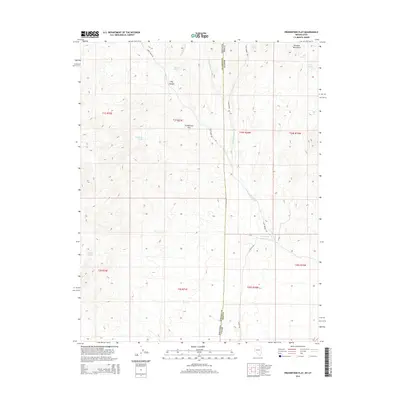
2014 Map of Prohibition Flat
USGS Topo · Published 2014About this map
Prohibition Flat lies at the heart of this high-altitude basin where the border of Lincoln County, Nevada, and Iron County, Utah, intersects. The landscape is defined by its water sources, including Prohibition Spring, Newels Spring, and Hackett Spring, which supported livestock and early travelers in this arid region. The drainage patterns of Gold Springs Wash and Midnight Wash carve through the terrain, directed southward toward the Rose Valley Reservoir. To the northeast, the foothills of the Paradise Mountains rise above the flat, offering a stark contrast to the canyon systems like Fay Canyon. This survey captures the remote intersection of two states, showing the primitive road network including Deer Lodge Rd and Devils Trl that provided access to the isolated springs and mountain passes during the early 21st century.
Find a feature on this map
25 named features on this map. Tap any name to fly to it.
Don’t see what you’re looking for? This feature index may not catch every label — zoom into the map to look around manually.
Map Details
Editions of this 2014 Prohibition Flat Map
This is the sole edition of this map. No revisions or reprints were ever made.
Other maps of this area

1885 · St. George
USGS Topo · 1:250,000

1885 · Pioche
USGS Topo · 1:250,000

1886 · Pioche
USGS Topo · 1:250,000

1891 · St. George
USGS Topo · 1:250,000

1953 · Cedar City
USGS Topo · 1:250,000

1954 · Caliente
USGS Topo · 1:250,000

1958 · Cedar City
USGS Topo · 1:250,000

1959 · Caliente
USGS Topo · 1:250,000

1962 · Cedar City
USGS Topo · 1:250,000
1972 · Panaca Summit
USGS Topo · 1:24,000