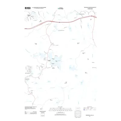
2013 Map of Promised Land
USGS Topo · Published 2013About this map
The Pocono Mountains define this high-altitude landscape, characterized by an intricate network of glacial lakes and wetlands in Pike County. The settlement of Promised Land sits at the heart of the quadrangle, positioned between Promised Land Lake and Lower Lake. This area reflects a mid-to-late 20th-century transition toward recreational and seasonal residential development, seen in the plotted streets of Tanglewood Estate and Sky View Lake. Preservation efforts are anchored by the Bruce Lake Natural Area, which protects Bruce Lake and Egypt Meadow Lake from encroaching development. To the south, the terrain rises toward Mud Pond Mountain and East Mountain, while the High Knob Fire Tower stands as a sentinel over the surrounding ridges, including Big Dam Ridge and Rock Oak Ridge. The presence of small hamlets like Blooming Grove and Roemersville suggests older crossroads communities that have persisted alongside newer lakeside developments.
Find a feature on this map
107 named features on this map. Tap any name to fly to it.
Don’t see what you’re looking for? This feature index may not catch every label — zoom into the map to look around manually.
Map Details
Editions of this 2013 Promised Land Map
This is the sole edition of this map. No revisions or reprints were ever made.
Other maps of this area

1919 · Pocono
USGS Topo · 1:62,500

1921 · Pocono
USGS Topo · 1:62,500

1923 · Pocono
USGS Topo · 1:62,500

1924 · Bushkill
USGS Topo · 1:48,000

1928 · Ariel
USGS Topo · 1:62,500

1932 · Ariel
USGS Topo · 1:62,500

1935 · Hawley
USGS Topo · 1:62,500

1938 · Hawley
USGS Topo · 1:62,500

1943 · Bushkill
USGS Topo · 1:62,500

1943 · Pocono
USGS Topo · 1:62,500
Featured Places
- Blooming Grove Township, PA
- Greene Township, PA
- Barrett Township, PA
- Palmyra Township, PA
- Promised Land, Greene Township