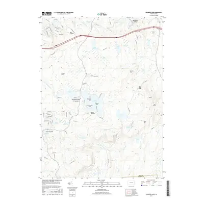
2016 Map of Promised Land
USGS Topo · Published 2016About this map
Promised Land Lake and its surrounding state park lands anchor this high-elevation pocket of the Pocono Mountains. The landscape is defined by an intricate network of glacial lakes and wetlands, including Egypt Meadow Lake, Bruce Lake, and the remote Lake Laura. These water bodies are connected by numerous small drainages like Shohola Creek and Wilson Creek, which wind through a series of named ridges such as Bear Trap Mountain and Big Dam Ridge.
Find a feature on this map
111 named features on this map. Tap any name to fly to it.
Don’t see what you’re looking for? This feature index may not catch every label — zoom into the map to look around manually.
Map Details
Editions of this 2016 Promised Land Map
This is the sole edition of this map. No revisions or reprints were ever made.
Other maps of this area

1919 · Pocono
USGS Topo · 1:62,500

1921 · Pocono
USGS Topo · 1:62,500

1923 · Pocono
USGS Topo · 1:62,500

1924 · Bushkill
USGS Topo · 1:48,000

1928 · Ariel
USGS Topo · 1:62,500

1932 · Ariel
USGS Topo · 1:62,500

1935 · Hawley
USGS Topo · 1:62,500

1938 · Hawley
USGS Topo · 1:62,500

1943 · Bushkill
USGS Topo · 1:62,500

1943 · Pocono
USGS Topo · 1:62,500
Featured Places
- Blooming Grove Township, PA
- Greene Township, PA
- Barrett Township, PA
- Palmyra Township, PA
- Promised Land, Greene Township