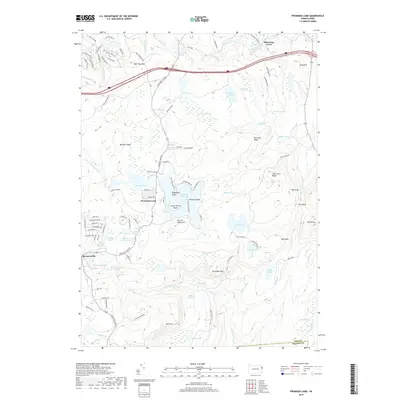
2019 Map of Promised Land
USGS Topo · Published 2019About this map
Pocono Mountains terrain defines this portion of Pike County, where the settlement of Promised Land sits at the heart of an extensive glacial lake and wetland system. The geography is dominated by major water bodies including Promised Land Lake, Lower Lake, and the more secluded Bruce Lake, surrounded by a dense network of named swamps such as Panther Swamp and Balsam Swamp. This 2019 survey illustrates the established recreational and residential character of the region, showing modern road developments like Yacht Club Dr and Eagle Crest Rd alongside natural landmarks like Conservation Island and Ridgefield Point.
Find a feature on this map
121 named features on this map. Tap any name to fly to it.
Don’t see what you’re looking for? This feature index may not catch every label — zoom into the map to look around manually.
Map Details
Editions of this 2019 Promised Land Map
This is the sole edition of this map. No revisions or reprints were ever made.
Other maps of this area

1919 · Pocono
USGS Topo · 1:62,500

1921 · Pocono
USGS Topo · 1:62,500

1923 · Pocono
USGS Topo · 1:62,500

1924 · Bushkill
USGS Topo · 1:48,000

1928 · Ariel
USGS Topo · 1:62,500

1932 · Ariel
USGS Topo · 1:62,500

1935 · Hawley
USGS Topo · 1:62,500

1938 · Hawley
USGS Topo · 1:62,500

1943 · Bushkill
USGS Topo · 1:62,500

1943 · Pocono
USGS Topo · 1:62,500
Featured Places
- Blooming Grove Township, PA
- Greene Township, PA
- Barrett Township, PA
- Palmyra Township, PA
- Promised Land, Greene Township