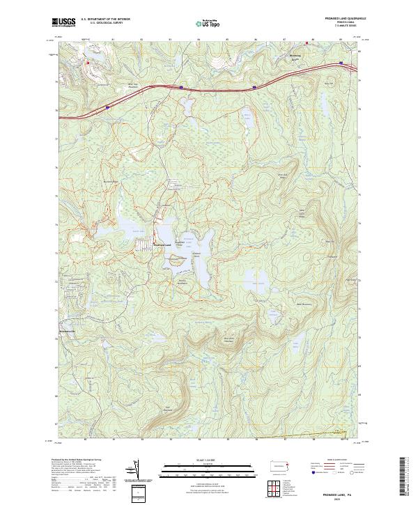
2023 Map of Promised Land
USGS Topo · Published 2023About this map
Promised Land sits at the heart of this high-plateau landscape within the Pocono Mountains, defined by an intricate network of glacial lakes and extensive wetlands. The settlement of Blooming Grove anchors the northern reaches, while the small community of Roemersville lies to the southwest near Wynooska Lake. This area of Pike County is characterized by its high-elevation terrain, including peaks like High Knob and Belle Mountain, and ridges such as Big Dam Ridge and Rock Oak Ridge.
Find a feature on this map
112 named features on this map. Tap any name to fly to it.
Don’t see what you’re looking for? This feature index may not catch every label — zoom into the map to look around manually.
Map Details
Editions of this 2023 Promised Land Map
This is the sole edition of this map. No revisions or reprints were ever made.
Other maps of this area

1919 · Pocono
USGS Topo · 1:62,500

1921 · Pocono
USGS Topo · 1:62,500

1923 · Pocono
USGS Topo · 1:62,500

1924 · Bushkill
USGS Topo · 1:48,000

1928 · Ariel
USGS Topo · 1:62,500

1932 · Ariel
USGS Topo · 1:62,500

1935 · Hawley
USGS Topo · 1:62,500

1938 · Hawley
USGS Topo · 1:62,500

1943 · Bushkill
USGS Topo · 1:62,500

1943 · Pocono
USGS Topo · 1:62,500
Featured Places
- Blooming Grove Township, PA
- Greene Township, PA
- Barrett Township, PA
- Porter Township, PA
- Palmyra Township, PA