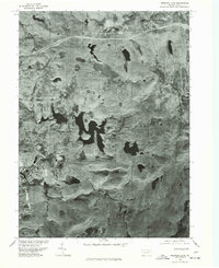
1976 Map of Promised Land
USGS Topo · Published 1978About this map
Promised Land and its surrounding woodlands are captured here through rectified photoimagery, revealing the intricate shoreline of Promised Land Lake and the smaller Lake Laura. Published by the Geological Survey in cooperation with the Soil Conservation Service, this orthophotoquad preserves the exact state of the Pike County landscape as it appeared in late 1976. The imagery highlights the contrast between the dense forest cover and the development emerging near Roemersville and Blooming Grove. A prominent segment of Route 84 cuts across the northern terrain, illustrating the modern infrastructure then integrating with these traditional recreation and settlement areas. Unlike a conventional topographic map, this photographic record shows the actual vegetation patterns and property clearings of the era.
Find a feature on this map
6 named features on this map. Tap any name to fly to it.
Don’t see what you’re looking for? This feature index may not catch every label — zoom into the map to look around manually.
Map Details
Editions of this 1976 Promised Land Map
This is the sole edition of this map. No revisions or reprints were ever made.
Other maps of this area

1919 · Pocono
USGS Topo · 1:62,500

1921 · Pocono
USGS Topo · 1:62,500

1923 · Pocono
USGS Topo · 1:62,500

1924 · Bushkill
USGS Topo · 1:48,000

1928 · Ariel
USGS Topo · 1:62,500

1932 · Ariel
USGS Topo · 1:62,500

1935 · Hawley
USGS Topo · 1:62,500

1938 · Hawley
USGS Topo · 1:62,500

1943 · Bushkill
USGS Topo · 1:62,500

1943 · Pocono
USGS Topo · 1:62,500
Featured Places
- Blooming Grove Township, PA
- Greene Township, PA
- Porter Township, PA
- Tanglewood Estate, Palmyra Township
- Roemersville, Greene Township