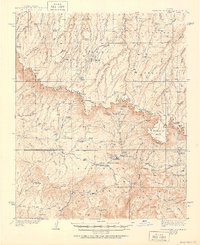
1939 Map of Promontory Butte
USGS Topo · Published 1951About this map
Promontory Butte and the dramatic drop of the Mogollon Rim anchor this mid-century survey of the rugged border between the Coconino National Forest and Tonto National Forest. The landscape is a network of isolated homesteads and forest service infrastructure, notably the Zane Grey Lodge and the State Fish Hatchery near the Indian Garden Ranger Sta. The mapping reveals the transition from the high plateau of Buck Ridge and Yeager Ridge down into the canyon country of the Gila Co basin.
Find a feature on this map
117 named features on this map. Tap any name to fly to it.
Don’t see what you’re looking for? This feature index may not catch every label — zoom into the map to look around manually.
Map Details
Editions of this 1939 Promontory Butte Map
3 editions found
Other maps of this area

1886 · Holbrook
USGS Topo · 1:250,000

1887 · Verde
USGS Topo · 1:250,000

1892 · Verde
USGS Topo · 1:250,000

1893 · Holbrook
USGS Topo · 1:250,000

1934 · Pine
USGS Topo · 1:62,500

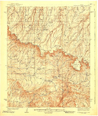
1934 · Promontory Butte
USGS Topo · 1:62,500

1936 · Payson
USGS Topo · 1:48,000

1937 · Diamond Butte
USGS Topo · 1:48,000

1939 · Promontory Butte
USGS Topo · 1:62,500

1940 · Pine
USGS Topo · 1:62,500
Featured Places
- Star Valley, AZ
- Bonita Creek Estates, AZ
- Thompson Draw Summer Homes Unit #1, AZ
- Tonto Estate, AZ
- Hunter Creek, AZ