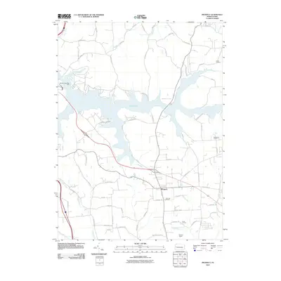
2010 Map of Prospect
USGS Topo · Published 2010About this map
Lake Arthur dominates the northern half of this landscape, its irregular fingers and coves formed by the Moraine State Park Dam. Established within the expansive Moraine State Park, the reservoir has altered the local geography, submerging older valley floors while preserving the higher elevations where the borough of Prospect and the settlement of Isle remain. The map captures a moment when recreational infrastructure, such as Camp Lutherlyn and various park facilities, coexists with the area's agricultural and genealogical foundations.
Find a feature on this map
68 named features on this map. Tap any name to fly to it.
Don’t see what you’re looking for? This feature index may not catch every label — zoom into the map to look around manually.
Map Details
Editions of this 2010 Prospect Map
This is the sole edition of this map. No revisions or reprints were ever made.
Other maps of this area

1908 · Zelienople
USGS Topo · 1:62,500

1909 · Butler
USGS Topo · 1:62,500

1910 · Zelienople
USGS Topo · 1:62,500

1910 · Hilliards
USGS Topo · 1:62,500

1911 · Butler
USGS Topo · 1:62,500

1912 · Hilliards
USGS Topo · 1:62,500

1913 · Mercer
USGS Topo · 1:62,500

1939 · Mercer
USGS Topo · 1:62,500

1943 · Mercer
USGS Topo · 1:62,500

1944 · Hilliards
USGS Topo · 1:62,500