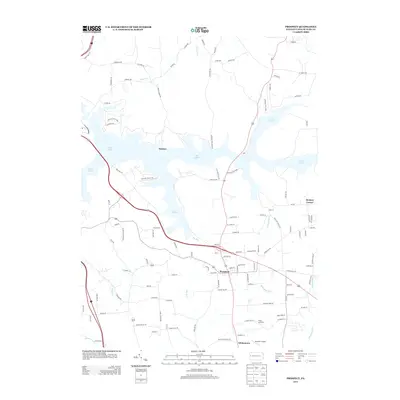
2013 Map of Prospect
USGS Topo · Published 2013About this map
Lake Arthur dominates the northern landscape, its irregular shoreline reaching into the valleys of Hogue Run and Big Run. This modern topographic study shows the extensive footprint of Moraine State Park, which preserves much of the lake's surrounding terrain. The borough of Prospect serves as the primary hub of settlement, positioned at the intersection of several regional corridors. To the south, the landscape transitions toward rural aviation and recreation at the Brandon Airport and Camp Lutherlyn. Small historic hamlets like Nealeys and Hickory Corner remain as distinct points on the map, while numerous small waterways such as Semiconon Run, Yellow Cr, and Mulligan Run drain the rolling countryside. This 2013 survey provides a contemporary perspective on how transportation and conservation have shaped these Butler County communities.
Find a feature on this map
111 named features on this map. Tap any name to fly to it.
Don’t see what you’re looking for? This feature index may not catch every label — zoom into the map to look around manually.
Map Details
Editions of this 2013 Prospect Map
This is the sole edition of this map. No revisions or reprints were ever made.
Other maps of this area

1908 · Zelienople
USGS Topo · 1:62,500

1909 · Butler
USGS Topo · 1:62,500

1910 · Zelienople
USGS Topo · 1:62,500

1910 · Hilliards
USGS Topo · 1:62,500

1911 · Butler
USGS Topo · 1:62,500

1912 · Hilliards
USGS Topo · 1:62,500

1913 · Mercer
USGS Topo · 1:62,500

1939 · Mercer
USGS Topo · 1:62,500

1943 · Mercer
USGS Topo · 1:62,500

1944 · Hilliards
USGS Topo · 1:62,500