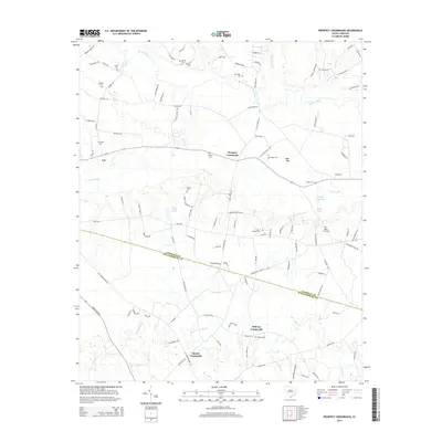
2014 Map of Prospect Crossroads
USGS Topo · Published 2014About this map
Lynches River winds across the northern reaches of this coastal plain landscape, defining a region where family-named landmarks and rural hubs have anchored the community for generations. The boundary between Florence Co and Williamsburg Co cuts through the southern portion of the map, separating agricultural tracts and timberlands. Small settlements such as Prospect Crossroads, Bartell Crossroads, and Midway Crossroads serve as central points in a network of rural roads including Bennie Landing Rd and Bartell Landing Rd, which suggest a long history of river access and local transit.
Find a feature on this map
110 named features on this map. Tap any name to fly to it.
Don’t see what you’re looking for? This feature index may not catch every label — zoom into the map to look around manually.
Map Details
Editions of this 2014 Prospect Crossroads Map
This is the sole edition of this map. No revisions or reprints were ever made.
Other maps of this area

1943 · Henry
USGS Topo · 1:24,000

1946 · Hyman
USGS Topo · 1:62,500

1946 · Johnsonville
USGS Topo · 1:62,500

1946 · Indiantown
USGS Topo · 1:62,500

1949 · Georgetown
USGS Topo · 1:250,000

1967 · Georgetown
USGS Topo · 1:250,000

1974 · Georgetown
USGS Topo · 1:250,000

1986 · Kingstree
USGS Topo · 1:100,000
1990 · Scranton
USGS Topo · 1:24,000
1990 · Pamplico South
USGS Topo · 1:24,000