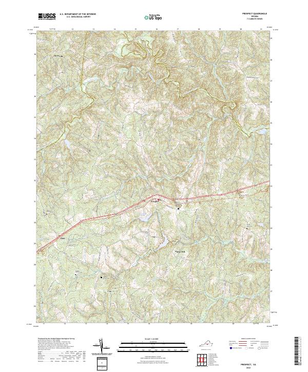
2022 Map of Prospect
USGS Topo · Published 2022About this map
The settlement of Prospect serves as a central hub in this Virginia landscape, situated along the path of the High Bridge Trl. This corridor, along with nearby Elam, reflects the historic transportation patterns that shaped Prince Edward County. The terrain is defined by a dense network of watercourses, including the Appomattox River forming the northern boundary and numerous tributaries like Falling Cr and Vaughans Cr.
Find a feature on this map
94 named features on this map. Tap any name to fly to it.
Don’t see what you’re looking for? This feature index may not catch every label — zoom into the map to look around manually.
Map Details
Editions of this 2022 Prospect Map
This is the sole edition of this map. No revisions or reprints were ever made.
Other maps of this area

1891 · Farmville
USGS Topo · 1:125,000

1892 · Appomattox
USGS Topo · 1:125,000

1893 · Farmville
USGS Topo · 1:125,000

1947 · Roanoke
USGS Topo · 1:250,000

1956 · Charlotte Court House
USGS Topo · 1:62,500

1958 · Farmville
USGS Topo · 1:62,500

1958 · Keysville
USGS Topo · 1:62,500

1958 · Pamplin City
USGS Topo · 1:62,500

1959 · Roanoke
USGS Topo · 1:250,000

1963 · Roanoke
USGS Topo · 1:250,000