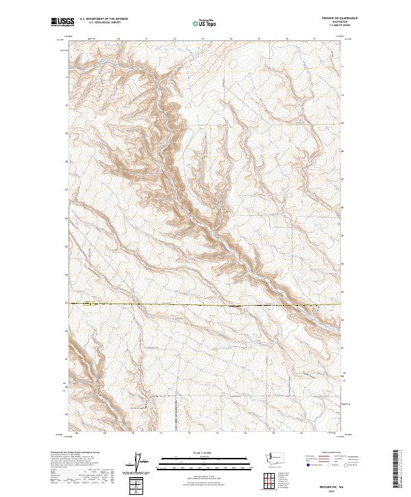
2023 Map of Prosser SW
USGS Topo · Published 2023About this map
Glade Creek meanders across this rural landscape in the high desert region of southern Washington. The terrain is characterized by a series of dramatic coulees and draws, including Dead Canyon and Coyote Canyon, which carve through the basalt plateaus. This 2023 survey documents the intersection of agricultural land and native shrub-steppe at the Yakima and Klickitat county line. While largely devoid of dense settlements, the map traces the network of local transport routes such as Alderdale Rd, Smith Rd, and Poeckes Rd that connect remote farmsteads and manage the seasonal water flow of the Yakima River basin. It offers a contemporary look at the sectioned township and range system that continues to define property and movement in this part of the state.
Find a feature on this map
1 named feature on this map. Tap any name to fly to it.
Don’t see what you’re looking for? This feature index may not catch every label — zoom into the map to look around manually.
Map Details
Editions of this 2023 Prosser SW Map
This is the sole edition of this map. No revisions or reprints were ever made.
Other maps of this area

1906 · Blalock Island
USGS Topo · 1:125,000

1908 · Blalock Island
USGS Topo · 1:125,000

1910 · Zillah
USGS Topo · 1:125,000

1915 · Prosser
USGS Topo · 1:125,000

1916 · Arlington
USGS Topo · 1:125,000

1917 · Prosser
USGS Topo · 1:125,000

1950 · Yakima
USGS Topo · 1:250,000

1953 · Pendleton
USGS Topo · 1:250,000

1953 · Walla Walla
USGS Topo · 1:250,000

1953 · The Dalles
USGS Topo · 1:250,000