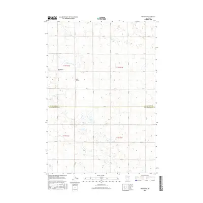
2016 Map of Providence
USGS Topo · Published 2016About this map
The Providence settlement serves as a central point in this prairie landscape, where the agricultural grid meets the winding course of the Lac qui Parle River. This 2016 survey captures a rural region straddling the border of Lac qui Parle and Yellow Medicine counties. The landscape is dotted with numerous small wetlands and basins, including Miller Lake, characteristic of the glacial till plains of western Minnesota. Local heritage is centered at the Swedish Methodist Church Cem, a site of significance for genealogists researching the area's Scandinavian pioneer roots. Waterways like Tenmile Cr and Spring Cr drain the surrounding fields, which are organized by a network of rural routes such as Co Hwy 2 and Co Rd 33.
Find a feature on this map
20 named features on this map. Tap any name to fly to it.
Don’t see what you’re looking for? This feature index may not catch every label — zoom into the map to look around manually.
Map Details
Editions of this 2016 Providence Map
This is the sole edition of this map. No revisions or reprints were ever made.
Other maps of this area

1953 · Watertown
USGS Topo · 1:250,000

1953 · New Ulm
USGS Topo · 1:250,000

1957 · New Ulm
USGS Topo · 1:250,000

1958 · New Ulm
USGS Topo · 1:250,000

1958 · Watertown
USGS Topo · 1:250,000
1965 · Tenmile Lake
USGS Topo · 1:24,000

1965 · Boyd
USGS Topo · 1:24,000

1967 · New Ulm
USGS Topo · 1:250,000

1967 · Dawson SW
USGS Topo · 1:24,000

1967 · Porter
USGS Topo · 1:24,000