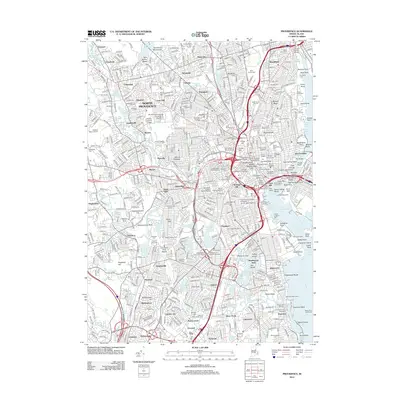
2012 Map of Providence
USGS Topo · Published 2012About this map
Brown University and Providence College anchor the academic landscape of this capital city, where the urban fabric is deeply intertwined with the Moshassuck River and Seekonk River. The mapping shows a dense network of neighborhoods including Olneyville, Mount Pleasant, and Elmwood, alongside significant industrial legacies like the Cranston Print Works Pond. Notable historic designations such as the Broadway Armory Historic District and Burrows Block Historic District reflect the preserved architectural heritage of the city's early development.
Find a feature on this map
166 named features on this map. Tap any name to fly to it.
Don’t see what you’re looking for? This feature index may not catch every label — zoom into the map to look around manually.
Map Details
Editions of this 2012 Providence Map
This is the sole edition of this map. No revisions or reprints were ever made.
Other maps of this area

1887 · Providence
USGS Topo · 1:62,500

1889 · Providence
USGS Topo · 1:62,500

1889 · Burrillville
USGS Topo · 1:62,500

1890 · Narragansett Bay
USGS Topo · 1:62,500

1890 · Kent
USGS Topo · 1:62,500

1892 · Narragansett Bay
USGS Topo · 1:62,500

1894 · Burrillville
USGS Topo · 1:62,500

1894 · Kent
USGS Topo · 1:62,500

1894 · Providence
USGS Topo · 1:62,500

1915 · Burrillville
USGS Topo · 1:62,500